Mot de passe perdu ?
Nouvel utilisateur ? Créer un compte
Clownfish, Philippines. Photo by Stephane Rochon.
Appréciez et contribuez !
| Trouvez les meilleurs sites |
|
|
 Saint Thomas Island
Virgin Islands
English (Traduisez ce texte en Français): Saint Thomas is part of the United States Virgin Islands (USVI), an unincorporated territory of the United States. Located on the island is the territorial capital and port of Charlotte Amalie. As of the 2000 census, the population of Saint Thomas was 51,181, about 47 percent of the U.S. Virgin Islands total. The district has a land area of 80.9 km² (31.24 sq mi). Source: Wikipedia.org
Plus d'informations
| Jan | Feb | Mar | Apr | May | Jun | Jul | Aug | Sep | Oct | Nov | Dec | |
|---|---|---|---|---|---|---|---|---|---|---|---|---|
| Climate | ||||||||||||
| Air temp. | ||||||||||||
| Water temp. | ||||||||||||
| Equipment | Don't know | Don't know | Don't know | Don't know | Don't know | Don't know | Don't know | Don't know | Don't know | Don't know | Don't know | Don't know |
| Best season | ||||||||||||
Cette carte est interactive ! Utilisez les boutons pour zoomer ou vous déplacer.
- Favoris
-
Vos sites favoris et futures listes de sites
Sites de plongée
| Sites de plongée (19) | Qualité | Prof moy | Prof max | Expérience | Type de plongée | ||
|---|---|---|---|---|---|---|---|
| Arches and Tunnels | 2 / - | 9.1 m | 15.2 m | Tous niveaux | 
|
||
| Calf Rock | - / - | 12 m | 14 m | Tous niveaux |
|
||
| Cartanza Señor Wreck | 4 / - | 21.3 m | 24.4 m | CMAS ** / AOW | 
|
||
| Christmas Cove | - / - | 8 m | 12 m | Tous niveaux | 
|
||
| Coki Beach | 9 / - | 8 m | 15 m | Tous niveaux |
|
||
| Cow Rock | - / - | 12 m | 15 m | Tous niveaux |
|
||
| Dive Flag Rock | - / - | 15.2 m | 19.8 m | Tous niveaux | 
|
||
| French Cap | - / - | 27.4 m | 30.5 m | CMAS ** / AOW | 
|
||
| General Rogers Wreck | - / - | 18.3 m | 21.3 m | Tous niveaux |
|
||
| Ledges of Little Saint James | - / - | 9.8 m | 15.2 m | Tous niveaux |
|
||
| Magens bay | - / - | 6 m | 8 m | Tous niveaux |
|
||
| Miss Opportunity Wreck | - / - | 22.9 m | 25.9 m | CMAS * / OW |
|
||
| Navy Barges | - / - | 10.7 m | 12.2 m | Tous niveaux |
|
||
| Saba Island | - / - | 12.2 m | 18.3 m | CMAS * / OW |
|
||
| Secret Harbour | - / - | 4.6 m | 4.6 m | Tous niveaux |
|
||
| Sprat | 3 / - | 9.8 m | 18.3 m | Tous niveaux |
|
||
| Stragglers Rocks | - / - | 12 m | 15 m | Tous niveaux |
|
||
| WIT Concrete Wreck | - / - | 21.9 m | 31.1 m | CMAS * / OW |

|
||
| WIT Shoal Wreck | - / - | 22.9 m | 27.4 m | CMAS ** / AOW |
|
 Photos

Arches and Tunnels |
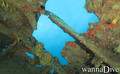
Cartanza Senor Wreck |

Cartanza Senor Wreck |

Cartanza Senor Wreck |
Dernières plongée
|
Commentaires
Soyez le(la) premier(e) à commenter ce pays
Erreurs, Réactions
Vous pouvez corriger des erreurs ou ajouter de nouvelles informations sur cette page. Si vous avez d'autres commentaires à faire sur cette page, Dite-le nous.
Annonceurs
Wannadive.net 24/24
Wannadive.net sur votre portable
![]()
RSS Tous les flux RSS de Wannadive.net
Newsletter Toutes les nouveautés par courriel