Mot de passe perdu ?
Nouvel utilisateur ? Créer un compte
Lizard fish, Philippines. Photo by Stephane Rochon.
Appréciez et contribuez !
| Trouvez les meilleurs sites |
|
|
![]() South Korea
South Korea
Asie
Localisation: Eastern Asia, southern half of the Korean Peninsula bordering the Sea of Japan and the Yellow Sea
Coordonnées géographiques: 38° 30' N, 127° 9' E
Côte: 2,413 km km
Climat: temperate, with rainfall heavier in summer than winter
Relief: mostly hills and mountains; wide coastal plains in west and south
Sommets:
Risques naturels: occasional typhoons bring high winds and floods; low-level seismic activity common in southwest
Monnaie: South Korean won (KRW)
Population:
Langues: Korean
Capitale:
Découpage administratif:
Plus d'informations
| Jan | Feb | Mar | Apr | May | Jun | Jul | Aug | Sep | Oct | Nov | Dec | |
|---|---|---|---|---|---|---|---|---|---|---|---|---|
| Climate | ||||||||||||
| Air temp. | ||||||||||||
| Water temp. | ||||||||||||
| Equipment | ||||||||||||
| Best season | ||||||||||||
Vous voulez ajouter des informations sur South Korea? Dites-le nous...
Cette carte est interactive ! Utilisez les boutons pour zoomer ou vous déplacer.
- Favoris
-
Vos sites favoris et futures listes de sites
Sites de plongée
| Sites de plongée (7) | Qualité | Prof moy | Prof max | Expérience | Type de plongée | ||
|---|---|---|---|---|---|---|---|
| Flower garden | 3 / - | 20 m | 23 m | CMAS ** / AOW | 
|
||
| Gijam | 3 / - | 10 m | 13 m | Tous niveaux |
|
||
| Jeju Moon-Island | 5 / - | 15 m | 25 m | Tous niveaux | 
|
||
| Nagok sunken vessel No1 | 2 / - | 18 m | 22 m | CMAS ** / AOW | 
|
||
| Nagok sunken vessel No2 | 3 / - | 22 m | 25 m | CMAS ** / AOW |
|
||
| Nagok Wreck | 3 / - | 20 m | 24 m | CMAS ** / AOW |
|
||
| Sungsunaegi | 1 / - | 19 m | 22 m | CMAS ** / AOW |
|
 Photos
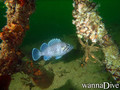
Buk-myeon Wreck |
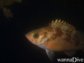
Buk-myeon Wreck |
Buk-myeon Wreck |

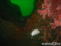
Flower garden |
Commentaires
Soyez le(la) premier(e) à commenter ce pays
Erreurs, Réactions
Si vous voulez ajouter de nouvelles informations ou si vous avez trouvé des erreurs sur cette page, Dite-le nous.
Annonceurs
Wannadive.net 24/24
Wannadive.net sur votre portable
![]()
RSS Tous les flux RSS de Wannadive.net
Newsletter Toutes les nouveautés par courriel